GPS Tracking
The Units Map page displays the real-time GPS positions of all response units on an interactive map. Operators can see exactly where each unit is located, whether they are moving toward a dispatched site, and how close they are to active events. This geographic awareness is essential for efficient dispatch decisions and monitoring response progress.
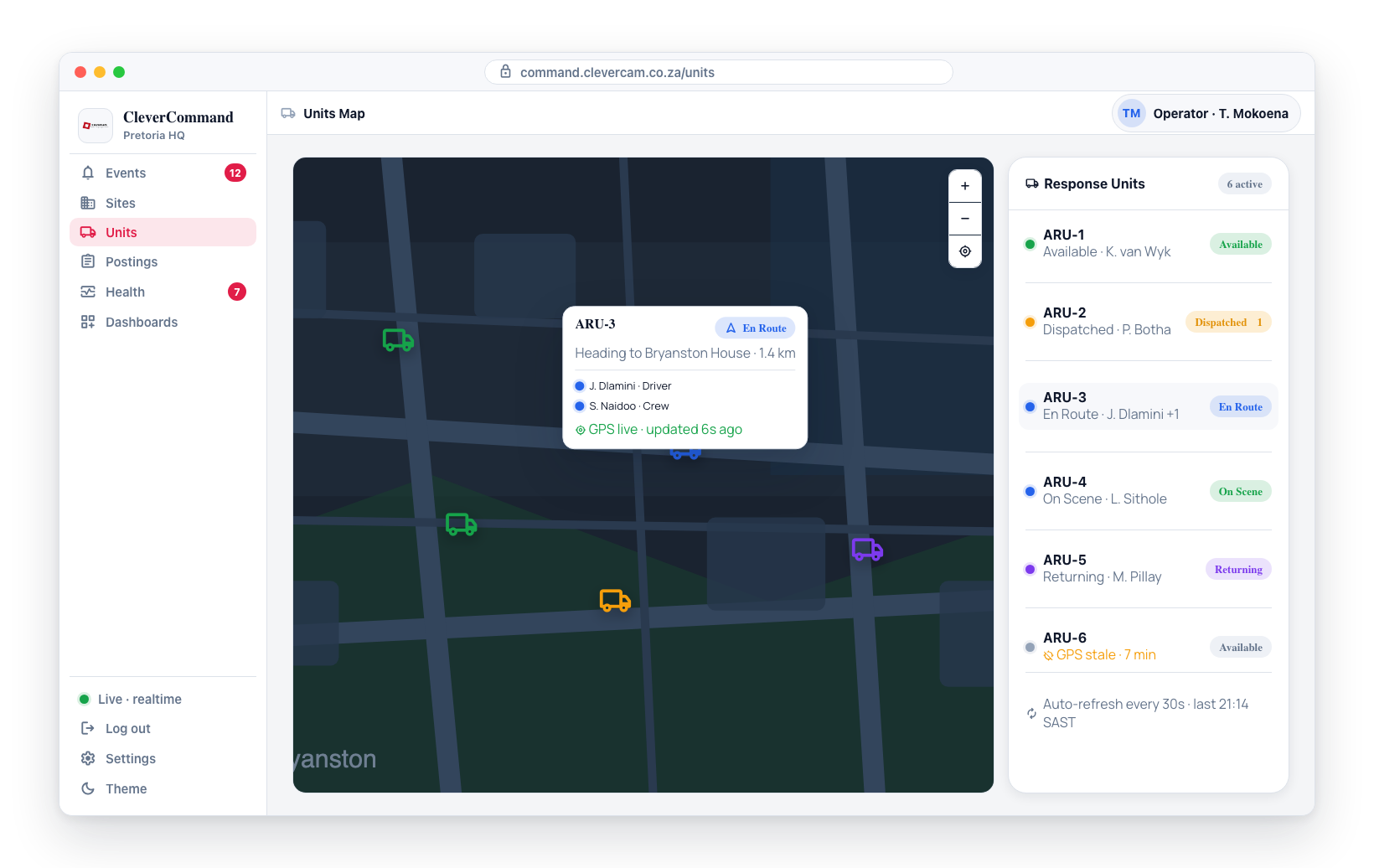
Accessing the Units Map
- Click Units in the left sidebar
- The map loads showing the current positions of all response units
Units is a standard feature for control rooms with the Advanced Alarm Handling module — it appears in the sidebar for every operator, with nothing to switch on. If Units is not in your sidebar, your control room does not have the module; your company administrator manages that in CleverOps.
Unit Markers
Each response unit is represented by a marker on the map showing:
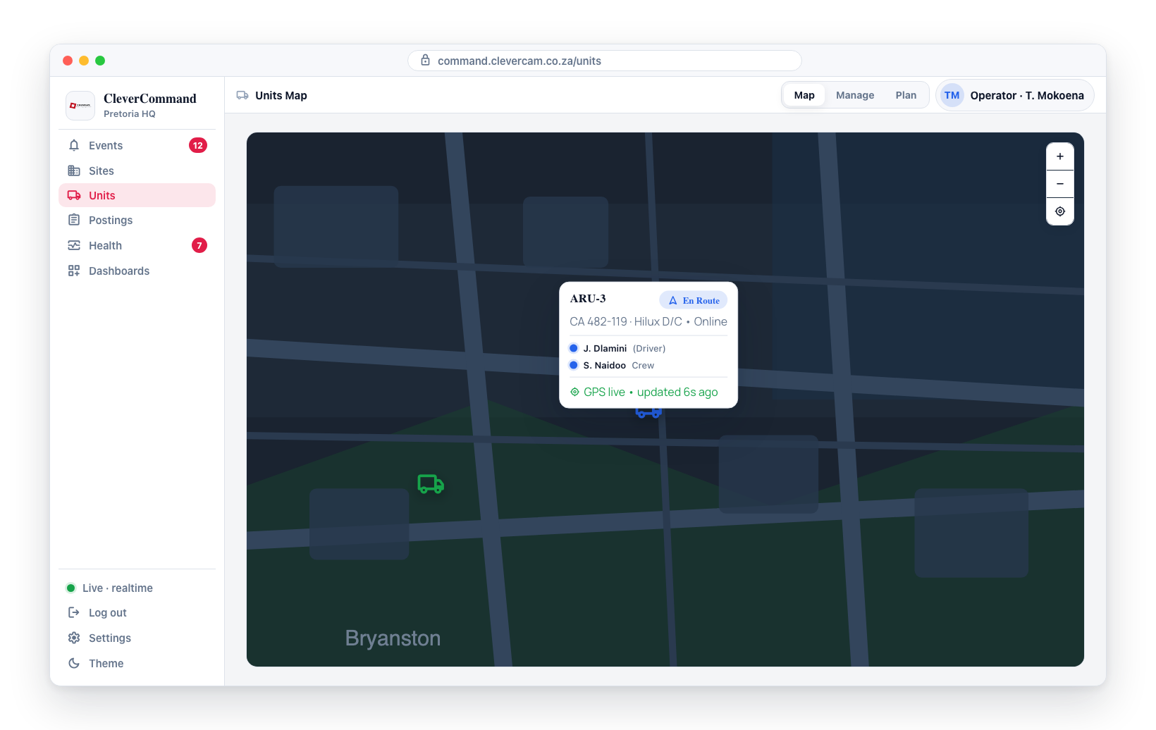
| Field | Description |
|---|---|
| Unit name | Identifier for the response unit |
| Status | Current status (Available, Dispatched, En Route, On Scene, etc.) |
| Assigned responders | Names of responders currently assigned to the unit |
| GPS position | Last reported location |
GPS Sources
Response unit positions come from two potential sources:
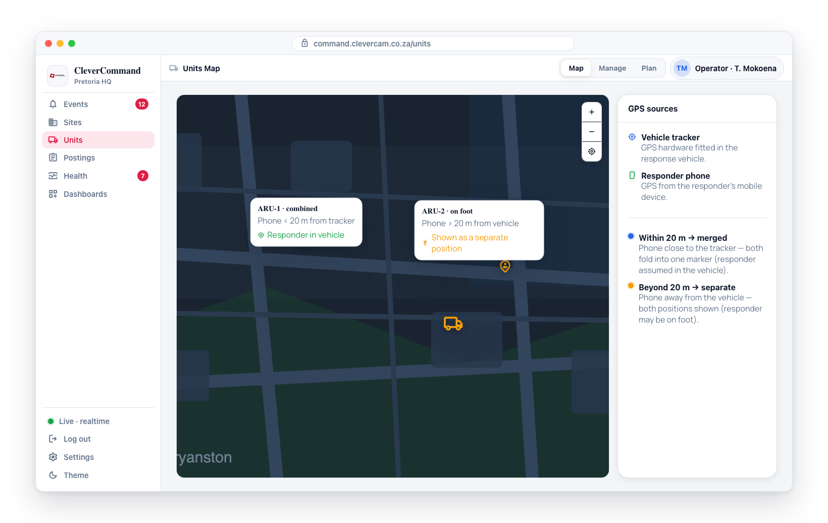
- Vehicle tracker -- GPS hardware installed in the response vehicle
- Responder phone -- GPS from the responder's mobile device
When both sources are available:
- If the responder's phone is within 20 meters of the vehicle tracker, the positions are combined into a single marker (the responder is assumed to be in the vehicle)
- If the phone is more than 20 meters from the vehicle, both positions may be shown separately (the responder may be on foot away from the vehicle)
Stale GPS Detection
GPS signals can become outdated if a device loses connectivity or enters an area with poor signal:
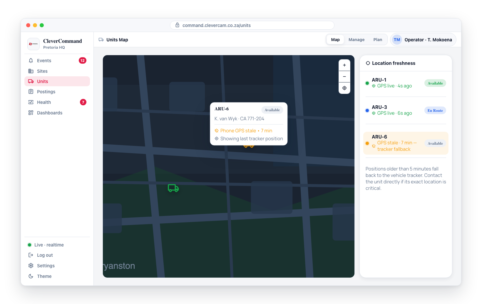
- If a GPS position has not updated for 5 or more minutes, the system falls back to the vehicle tracker position
- Outdated position indicators help operators understand the freshness of location data
- A unit with an outdated GPS position should be contacted directly if their location is critical for a dispatch decision
Units that have gone silent
A position older than 24 hours is not shown. When a unit's vehicle tracker has not reported for a day — switched off, faulty, or never fitted — the unit has no marker on the map (a crew member whose phone is sharing a live location still shows on their own). The unit stays in the sidebar list with a grey tracker dot and no GPS 24h+ next to its vehicle; hover the dot to see when the tracker last reported. The tracker's own online flag is not trusted for this, because a tracker can still read online long after its last report.
The cut-off is a full day on purpose, so a unit on a patchy signal never blinks on and off. The marker comes back by itself with the tracker's next report — the map refreshes every 30 seconds.
The same rule applies wherever a unit's position is used: the Plan board's Nearest chip, the unit list and map on an event, and the Wall Map dashboard, which also leaves off fleet vehicles whose tracker has been silent for a day.
GPS positions are estimates and may not be perfectly accurate, especially in dense urban areas, underground parking, or areas with poor mobile signal. Always verify critical positions by contacting the unit directly if needed.
Using GPS Tracking for Dispatch
The Units Map helps operators make informed dispatch decisions:
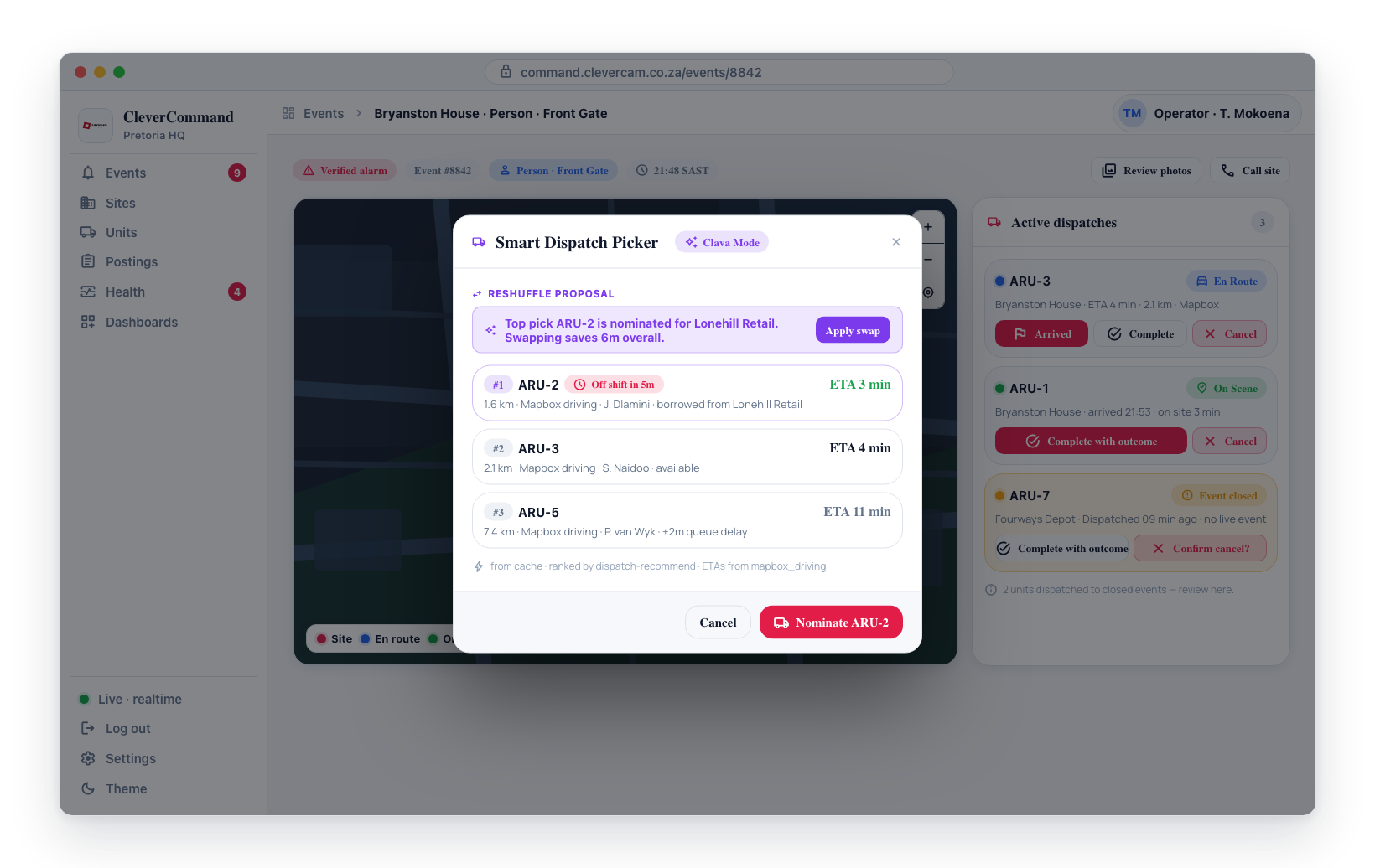
- An event is verified and needs a response unit
- Open the Units Map to see the current positions of all available units
- Identify the unit closest to the event location
- Dispatch that unit for the fastest response time
- Monitor the unit's movement toward the site on the map
Map Features
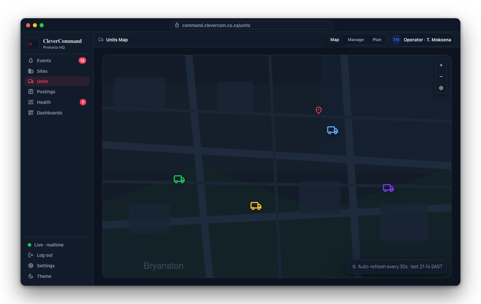
- Pan and zoom -- Navigate the map freely
- Dark mode support -- Map styling adapts to your theme preference (light or dark)
- Status indicators -- Unit markers are styled by status for quick visual identification
- Auto-refresh -- Positions update every 30 seconds to reflect current locations
During active dispatches, keep the Units Map visible on a secondary monitor so you can track unit movement toward the site without leaving the event queue on your primary screen.
Multiple Responders
A single response unit may have multiple responders assigned. The marker shows the unit as a whole, with responder names listed in the detail popup when you click the marker.